Friday, February 28, 2025

Melghat Tiger Reserve, Amravati – Contact Details

Melghat Tiger Reserve, Amravati – Contact Details

Gugamal Wildlife Division, Chikhaldara:

Deputy Conservator of Forest,

Gugamal wildlife division, Upper Plateau,

Near Botanical Garden,

Chikhaldara, Amaravati District – 444 807

Phone: +91 7220 230 229

Email: dycfwlgugamal@mahaforest.gov.in

Melghat Wildlife Division, Paratwada:

Divisional Forest Officer,

Melghat Wildlife Division,

Govt. Timber Depot Campus,

Paratwada, Amaravati District – 444 807

Phone: +91 7223 222 643

Email: dfomelghatwl@mahaforest.gov.in

Pandharkawada Wildlife Division, Pandharkawada:

Divisional Forest Officer,

Pandharkawada Wildlife Division,

Ratan Ginning Factory, Kelapur Taluk,

Yavatmal District – 445 302

Phone: +91 7235 227 520

Email: dfowlpkawda@mahaforest.gov.in

Sipna Wildlife Division, Paratwada:

Deputy Conservator of Forest,

Sipna Wildlife Division,

Govt. Timber Depot Campus, Paratwada,

Amravati District – 444 805

Phone: +91 7223 220 214

Email: dycfwlsipna@mahaforest.gov.in

Akot Wildlife Division, Akot:

Deputy Conservator of Forest

Akot Wildlife Division,

Akot-Popatkhed Road,

Govt. Timer Depot Campus, Akot – 444 101

Phone: +91 7258 203 306 / 203 711

Email: dycfwlakot@mahaforest.gov.in

Akola Wildlife Division, Akola:

Divisional Forest Officer,

Akola Wildlife Division,

In Front of District Session Court, 

Railway Station Road, Akola – 444 001

Phone: +91 724 241 0869

Email: dfowlakola@mahaforest.gov.in

Melghat Tiger Reserve, Amravati – The Tiger Reserve

Melghat Tiger Reserve, Amravati – The Tiger Reserve

Melghat Tiger Reserve is located on the southern offshoot of the Satpura Hill Range in Central India, called Gavilgarh Hill. The main ridge, called Gavilgarh Ridge, runs east-west forms the southwestern boundary of the reserve. It is a flat plateau on top, descending in abrupt and sharp precipitous scarps on both sides and then steep slopes down to narrow valleys. These abrupt variations in altitude, aspect and gradient are seen throughout the reserve. The plateau was earlier used for agriculture.

This ridge has its highest point at Vairat (1178 m. above msl.). Melghat has rugged topography with only a few entry points and is naturally protected from the outside interference. The Makhala, Chikhaldara, Chiladari, Patulda and Gugamal are the large plateaux amidst rugged terrain. The Melghat Tiger Reserve is divided into Sipna, Gugamal and Akot Wildlife Division, administratively. Presently, the total area of the reserve is around 1677 km2. The reserve is a catchment area for five major rivers namely Khandu, Khapra, Sipna, Gadga and Dolar.

These all rivers are tributaries of the river Tapti. The Tapti River flows through the northern part of Melghat Tiger Reserve and forms the boundary of the reserve together with the Gawilghur ridge of the Satpura Range. The sudden slope of Melghat forms the part of catchment of river Purna. The three major tributaries originating from Melghat region and draining into river Purna are Chandrabhaga, Adnani and Wan.

Flora:

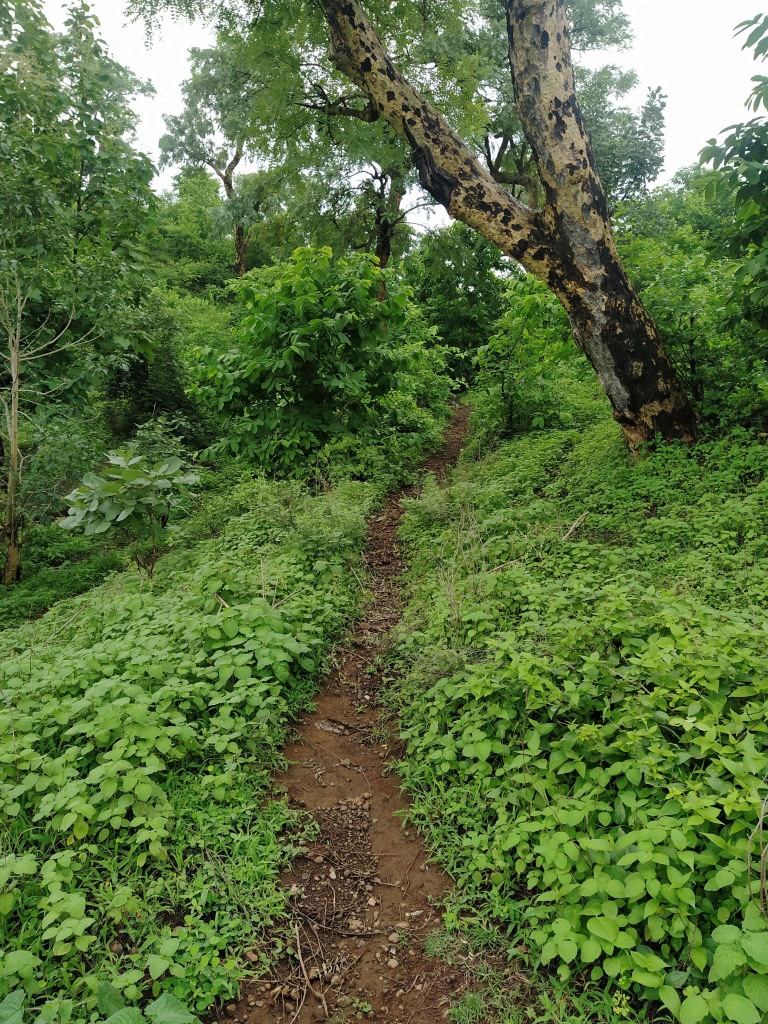
The habitat is a typical representative of the Central Indian Highland, forming a part of the Deccan Peninsula- Central Indian Highland biogeographically. The forest is southern tropical dry deciduous in nature, dominated by teak (Tectona grandis) and bamboo. The other tree species found in the forest are Tiwas, Bija, Haldu, Saja, Dhawda, Ain, Moha, Tendu, Achar, Amla, Behada, Bhilwa, Bor, Mango, Khair, Jamun, Apta, Bel and Kulu.

There are patches of semi-evergreen and moist deciduous forests. There are grassy meadows throughout the reserve, especially on the hilltops. There are many species of orchids, ferns, grasses, and other herbs. The common epiphytic orchids are Aerides, Rhynchostylis and Vanda. Ceropegia odorata, an extremely rare species, is found in this area. More than 769 species of plants have been recorded in the reserve.

Fauna:

The faunal diversity of this reserve includes 30 species of reptiles, 74 of butterflies, 23 of fish, 5 species of amphibians and 26 species of spiders. The main fauna found in this reserve are Bengal tiger, Indian leopard, sloth bear, dhole, Indian jackal, sambar, gaur, barking deer, nilgai, chital, chausingha, honey badger, flying squirrel, wild boar, langur, rhesus monkey, Indian porcupine, Indian pangolin, mouse deer, python, smooth-coated otter and black-naped hare. The Caracal is also reported here, along with many other smaller cats. This reserve has 252 species of birds.

Some of them are Fairy Bluebird, Great Black Woodpecker, Stork-billed Kingfisher, Black-capped Kingfisher, Little Green Heron, Black-crowned Night Heron, Sparrowhawk, Crested Bunting, Grey jungle fowl, Indian Peafowl, Grey Francolin, Painted Francolin, Red Spurfowl, Greater Racket-tailed Drongo, White-bellied Drongo, Indian Grey Hornbill, White-naped Woodpecker, Chestnut-bellied Nuthatch, Indian Pitta, Emerald Dove, Oriental Turtle Dove, Sirkeer Malkoha, Malabar Whistling Thrush, Orange-headed Thrush, Indian Scimitar Babbler, Black-hooded Oriole, Large Cuckoo shrike, Scarlet Minivet, Verditer Flycatcher, Asian Paradise-flycatcher, Crested Bunting, crested serpent Eagle, Oriental Honey-buzzard, Eurasian Hobby, Bonelli's Eagle, Mottled Wood Owl and Jungle Owlet.

Tribals:

There are more than ten villages in the core area in Sipna and Gugamal Wildlife Division. There are no villages in the Akot division. There are 61 villages in the reserve, all outside the core area. 22 are in the buffer zone and 39 in the Multiple Use Area (MUA). The inhabitants are mainly tribal, largely of the Korku tribe (80 %) and others like Gond, Nihal, Balai, Gaolan, Gawali, Halbi, Wanjari, and Maratha. All inhabitants depend on the forest for bona fide domestic needs of firewood, timber, fodder, medicinal plants, and non-timber forest products like fruit, flowers, gum, and medicinal plants. Their main source of income is from labour and rainy season agriculture. They augment their income by collecting non-timber forest products like mahuali, flowers, seeds, charoli, gumcula, dhawada, tendu-leaves, and musali (a medicinal plant).

Melghat Tiger Reserve, Amravati, Maharashtra

Melghat Tiger Reserve, Amravati, Maharashtra

Melghat Tiger Reserve is a tiger reserve located in the northern part of Amravati District in the Indian State of Maharashtra. It is situated on southern offshoot of the Satpura Hill Range in Central India, called Gavilgarh hill. It was among the first nine tiger reserves of India to be notified in 1973 under Project Tiger. The total area of the reserve is around 1677 km2. Melghat means meeting of the ghats, which describes the area as a large tract of unending hills and ravines scarred by jagged cliffs and steep climbs. Melghat is the prime biodiversity repository of the state.


History

Melghat was established as a wildlife sanctuary in 1967 and was declared a tiger reserve in 1974. It was among the first nine tiger reserves notified in 1973-74 under Project Tiger, a wildlife conservation project initiated in India in 1972 to protect Bengal tigers. The core area of the Reserve, the Gugarnal National Park with an area of 361.28 sq. km., and buffer area of the Reserve, the Melghat Tiger Sanctuary with an area of 788.28 sq. km. (of which 21.39 sq. km. is non-forest), were together re-notified by the state government in 1994 as Melghat Sanctuary. The remaining area is managed as a multiple use area.


Previously, Melghat Tiger Sanctuary was created in 1985 with an area of 1597.23 sq. km.  Gugarnal National Park was carved out of this Sanctuary in 1987. The core area of the Reserve, the Gugarnal National Park and buffer area of the Reserve, the Melghat Tiger Sanctuary were together re-notified by the state government in 1994 as Melghat Sanctuary. There are passes in Melghat that Kings from the north traversed to reach Berar, where the Imad Shahi dynasty had been founded in 1484. Colonel Arthur Wellesley, who later became the Duke of Wellington, captured the Gavilgarh fort from the Marathas in 1803 CE during the second Maratha war.


The Tiger Reserve

For brief details, please refer below link;

https://explore-natural-beauty-of-india.blogspot.com/2025/02/melghat-tiger-reserve-amravati-tiger-reserve.html

Best Season

Tourists can explore Melghat in all seasons but the monsoons starting mid-July till end of September offers the best views. The winters are cold with night temperature dropping below 5 degrees. The summers are good for animal sightings.

Accommodation

Accommodation facilities in Melghat are mostly run by the forest department except the hotels and resorts at Chikhaldara which are operated by private. Facilities are comfortable and basic in nature suiting the forest atmosphere where it is located.

Contact Details

For brief details, please refer below link;

https://explore-natural-beauty-of-india.blogspot.com/2025/02/melghat-tiger-reserve-amravati-contact-details.html

Connectivity

Melghat Tiger Reserve can be accessed from Chikhaldara, Semadoh, Kolkas and Harisal. Semadoh is considered as the main entrance for this tiger reserve. Semadoh is located at about 24 Kms from Harisal, 27 Kms from Chikhaldara, 33 Kms from Kolkas, 46 Kms from Paratwada Bus Stand, 47 Kms from Paratwada, 94 Kms from Amravati, 96 Kms from Shahanur, 98 Kms from Amravati Railway Station and 236 Kms from Nagpur Airport. Semadoh is situated on Paratwada to Harisal route.

Location

Jatashankar Waterfall, Wasadi, Maharashtra

Jatashankar Waterfall, Wasadi, Maharashtra

Jatashankar Waterfall is a natural waterfall located in Wasadi Village in Sangrampur Taluk in Buldhana District in the Indian state of Maharashtra. This waterfall is situated in the Satpuda range inside the Amba Barwa Wildlife Sanctuary. The waterfall can be reached after a trek of about 3 kms from the parking area. It is advisable to visit this waterfall during monsoon when it is in full glory. There is a temple of Jatashankar dedicated to Lord Shiva completely engulfed inside a tree. There is an entry fee to enter this waterfall.


Connectivity

The waterfall is located at about 4 Kms from Ambabarwa Ecotourism Center, 10 Kms from Tunki Bk., 23 Kms from Jalgaon Jamod, 32 Kms from Telhara, 48 Kms from Akot, 48 Kms from Akot Railway Station and 247 Kms from Aurangabad Airport. The waterfall is situated at about 10 Kms to the northwest of Tunki Bk on Akot to Jalgaon Jamod route.

Location

Amba Barwa Wildlife Sanctuary, Maharashtra

Amba Barwa Wildlife Sanctuary, Maharashtra

Amba Barwa Wildlife Sanctuary is a wildlife sanctuary situated in Satpuda hills of Buldhana District in the Indian state of Maharashtra. This sanctuary forms a part of the larger Melghat Tiger Reserve. The sanctuary was established on 9th April 1997. The Sanctuary is under the Chief Conservator of forest and Field Director, Melghat Tiger Reserve with headquarters at Amravati.


The Wildlife Sanctuary

The sanctuary area include reserved forest of about 102.10 sq. km, protected forest of about 22.62 Sq. km and remaining land is private cultivation and Abadi lands from ex-forest villages of Ambabarwa, Chunkhadi and Rohinkhidki of Sangrampur Taluka of Buldhana District. The tourist zone of the sanctuary is 21.26 sq. km comprising eight forest compartments.


Flora:

The sanctuary comprises of tropical evergreen forests. Some of the tree species found in the forest are crape myrtle (Lagerstroemia parviflora), Indian ash tree (Lannea coromandelica), Indian gooseberry (Emblica officinalis), Asna tree (Terminalia tomentosa), dhawada tree (Anogeissus latifolia), Teak (Ougeinia oojeinensis), Indian frankincense (Boswellia serrata), Sweet Indrajao (wrightia tinctoria), golden shower tree (Cassia fistula), Miliusa tomentosa, yellow bauhinia (Bauhinia racemosa), and Flame of the forest (Butea monosperma).


Fauna:

The main fauna found in this reserve are tigers, leopards, sloth bears, wild dogs, dhole, jackal, sambar, gaur, barking deer, spotted deer, blue bull, Chausingha, ratel, flying squirrel, wild boar, rhesus macaque, porcupine, pangolin, mouse deer, black-naped hare, python, Indian vulture, forest owlet, and green avadavat.


Connectivity

The sanctuary is located at about 6 Kms from Tunki, 19 Kms from Sangrampur, 28 Kms from Jalgaon Jamod, 45 Kms from Akot, 45 Kms from Akot Railway Station, 109 Kms from Buldana and 286 Kms from Nagpur Airport. The sanctuary is situated at about 6 Kms to the north-west of Tunki on Jalgaon Jamod to Akot route.

Location

Bhairavgad Fort, Wari, Maharashtra

Bhairavgad Fort, Wari, Maharashtra

Bhairavgad Fort is a small hill fort situated in Wari Village in Telhara Taluk in Akola District in the Indian state of Maharashtra. It is situated on the banks of the Wan River. The fort is located on the border of Akola, Amravati, and Buldhana Districts.


The Fort

The fort is in a ruined state and situated on top of a small hill. This fort lies on the foothills of Satpura hill range. The entrance gate of fort can be reached after a trek of about 10 mins from the Wari village. The entrance gate and bastion are the only notable surviving structures of the fort. There is a newly built temple dedicated to Lord Bhairav near the entrance gate. Sculptures of Hindu deities can be seen beside the temple. The Hanuman Sagar dam built across Wan River can be seen from this fort.


Connectivity

The fort is located at about 8 Kms from Warkhed, 16 Kms from Tunki, 27 Kms from Telhara, 35 Kms from Akot, 35 Kms from Akot Railway Station, 121 Kms from Amravati, 160 Kms from Jalgaon Airport and 277 Kms from Aurangabad Airport. The fort is situated at about 8 Kms to the north of Warkhed on Tunki to Akot route.

Location

Wan Dam, Wari, Maharashtra

Wan Dam, Wari, Maharashtra

Wan Dam is an earth fill dam located in Wari Village in Telhara Taluk in Akola District in the Indian state of Maharashtra. This dam is locally called Wari Talav / Wari Lake. The dam was constructed in 1973 by the Government of Maharashtra.

The Dam

It is an earth fill gravity dam built across the Wari River. The height of the dam above its lowest foundation is 67.65 m (221.9 ft) while the length is 500 m (1,600 ft). The volume content is 599 km3 (144 cu mi) and gross storage capacity is 0.081 km3 (0.019 cu mi). This dam is a multipurpose dam used for irrigation and drinking water supply. The dam is also a popular tourist attraction and known for its scenic beauty. The dam is mainly used to irrigate agricultural land in the western Vidarbha.


Connectivity

The dam is located at about 9 Kms from Warkhed, 28 Kms from Telhara, 36 Kms from Akot, 36 Kms from Akot Railway Station, 39 Kms from Jalgaon Jamod and 279 Kms from Nagpur Airport. The dam is situated at about 9 Kms to the north of Warkhed on Akot to Jalgaon Jamod route.

Location

Jatra Doh Waterfall, Chikhaldara, Maharashtra

Jatra Doh Waterfall, Chikhaldara, Maharashtra Jatra Doh Waterfall  is a natural waterfall situated in Chikhaldara Hill Station in Chikhalda...