Friday, February 28, 2025

Jatashankar Waterfall, Wasadi, Maharashtra

Jatashankar Waterfall, Wasadi, Maharashtra

Jatashankar Waterfall is a natural waterfall located in Wasadi Village in Sangrampur Taluk in Buldhana District in the Indian state of Maharashtra. This waterfall is situated in the Satpuda range inside the Amba Barwa Wildlife Sanctuary. The waterfall can be reached after a trek of about 3 kms from the parking area. It is advisable to visit this waterfall during monsoon when it is in full glory. There is a temple of Jatashankar dedicated to Lord Shiva completely engulfed inside a tree. There is an entry fee to enter this waterfall.


Connectivity

The waterfall is located at about 4 Kms from Ambabarwa Ecotourism Center, 10 Kms from Tunki Bk., 23 Kms from Jalgaon Jamod, 32 Kms from Telhara, 48 Kms from Akot, 48 Kms from Akot Railway Station and 247 Kms from Aurangabad Airport. The waterfall is situated at about 10 Kms to the northwest of Tunki Bk on Akot to Jalgaon Jamod route.

Location

Amba Barwa Wildlife Sanctuary, Maharashtra

Amba Barwa Wildlife Sanctuary, Maharashtra

Amba Barwa Wildlife Sanctuary is a wildlife sanctuary situated in Satpuda hills of Buldhana District in the Indian state of Maharashtra. This sanctuary forms a part of the larger Melghat Tiger Reserve. The sanctuary was established on 9th April 1997. The Sanctuary is under the Chief Conservator of forest and Field Director, Melghat Tiger Reserve with headquarters at Amravati.


The Wildlife Sanctuary

The sanctuary area include reserved forest of about 102.10 sq. km, protected forest of about 22.62 Sq. km and remaining land is private cultivation and Abadi lands from ex-forest villages of Ambabarwa, Chunkhadi and Rohinkhidki of Sangrampur Taluka of Buldhana District. The tourist zone of the sanctuary is 21.26 sq. km comprising eight forest compartments.


Flora:

The sanctuary comprises of tropical evergreen forests. Some of the tree species found in the forest are crape myrtle (Lagerstroemia parviflora), Indian ash tree (Lannea coromandelica), Indian gooseberry (Emblica officinalis), Asna tree (Terminalia tomentosa), dhawada tree (Anogeissus latifolia), Teak (Ougeinia oojeinensis), Indian frankincense (Boswellia serrata), Sweet Indrajao (wrightia tinctoria), golden shower tree (Cassia fistula), Miliusa tomentosa, yellow bauhinia (Bauhinia racemosa), and Flame of the forest (Butea monosperma).


Fauna:

The main fauna found in this reserve are tigers, leopards, sloth bears, wild dogs, dhole, jackal, sambar, gaur, barking deer, spotted deer, blue bull, Chausingha, ratel, flying squirrel, wild boar, rhesus macaque, porcupine, pangolin, mouse deer, black-naped hare, python, Indian vulture, forest owlet, and green avadavat.


Connectivity

The sanctuary is located at about 6 Kms from Tunki, 19 Kms from Sangrampur, 28 Kms from Jalgaon Jamod, 45 Kms from Akot, 45 Kms from Akot Railway Station, 109 Kms from Buldana and 286 Kms from Nagpur Airport. The sanctuary is situated at about 6 Kms to the north-west of Tunki on Jalgaon Jamod to Akot route.

Location

Bhairavgad Fort, Wari, Maharashtra

Bhairavgad Fort, Wari, Maharashtra

Bhairavgad Fort is a small hill fort situated in Wari Village in Telhara Taluk in Akola District in the Indian state of Maharashtra. It is situated on the banks of the Wan River. The fort is located on the border of Akola, Amravati, and Buldhana Districts.


The Fort

The fort is in a ruined state and situated on top of a small hill. This fort lies on the foothills of Satpura hill range. The entrance gate of fort can be reached after a trek of about 10 mins from the Wari village. The entrance gate and bastion are the only notable surviving structures of the fort. There is a newly built temple dedicated to Lord Bhairav near the entrance gate. Sculptures of Hindu deities can be seen beside the temple. The Hanuman Sagar dam built across Wan River can be seen from this fort.


Connectivity

The fort is located at about 8 Kms from Warkhed, 16 Kms from Tunki, 27 Kms from Telhara, 35 Kms from Akot, 35 Kms from Akot Railway Station, 121 Kms from Amravati, 160 Kms from Jalgaon Airport and 277 Kms from Aurangabad Airport. The fort is situated at about 8 Kms to the north of Warkhed on Tunki to Akot route.

Location

Wan Dam, Wari, Maharashtra

Wan Dam, Wari, Maharashtra

Wan Dam is an earth fill dam located in Wari Village in Telhara Taluk in Akola District in the Indian state of Maharashtra. This dam is locally called Wari Talav / Wari Lake. The dam was constructed in 1973 by the Government of Maharashtra.

The Dam

It is an earth fill gravity dam built across the Wari River. The height of the dam above its lowest foundation is 67.65 m (221.9 ft) while the length is 500 m (1,600 ft). The volume content is 599 km3 (144 cu mi) and gross storage capacity is 0.081 km3 (0.019 cu mi). This dam is a multipurpose dam used for irrigation and drinking water supply. The dam is also a popular tourist attraction and known for its scenic beauty. The dam is mainly used to irrigate agricultural land in the western Vidarbha.


Connectivity

The dam is located at about 9 Kms from Warkhed, 28 Kms from Telhara, 36 Kms from Akot, 36 Kms from Akot Railway Station, 39 Kms from Jalgaon Jamod and 279 Kms from Nagpur Airport. The dam is situated at about 9 Kms to the north of Warkhed on Akot to Jalgaon Jamod route.

Location

Thursday, January 2, 2025

Kuno National Park – The National Park

Kuno National Park – The National Park

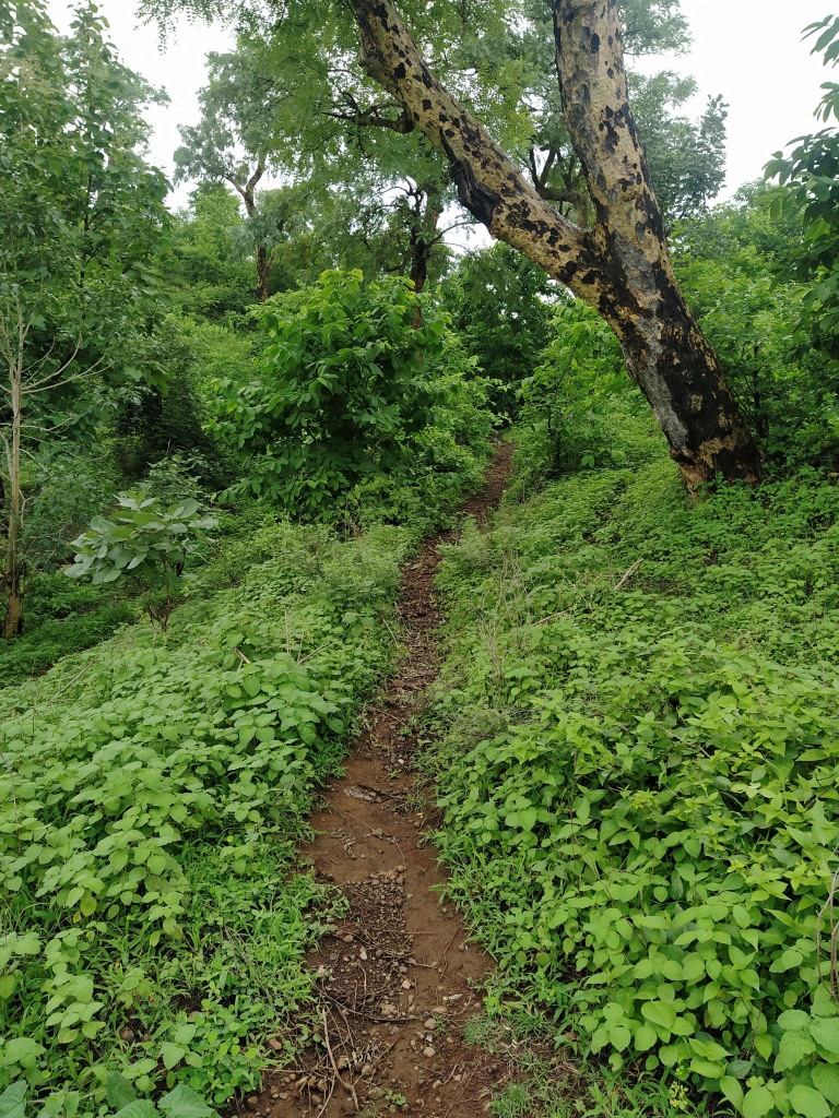
The national park is situated in an isolated hill, sloping in all directions. The national park covers an area of about 344.686 km2 out of which 313.984 km2 is forest land and 30.702 km2 is revenue land in the Sheopur and Vijapur tehsils of Sheopur district. The national park is situated almost in the centre of Kuno Wildlife Division of Sheopur district, and it is a part of the central Indian Vindhyan hills. The Kuno Wildlife Division has a total area of 1235 km2. The national park is in the shape of a leaf with Kuno river forming the main centre spine. The Kuno river, a tributary of River Chambal, vertically bisects the sanctuary from north to south.

It occupies an area of 5.90 km2 in the sanctuary. A number of major of major nallahs like Lankahkhoh, Kudikheda, Durredi, Aamkhoh originate from the gorges located on the west, join the Kuno river. Similarly, the Dabhona nallah, Naharkunda nallah, Gangoli nallah etc. originating from the eastern khohs, meet the Kuno river at various sites. The national park falls in the semi-arid zone and has a typical terrain of central Indian highlands, interspersed with woodlands and meadows. This park is situated at 180 meters at its lowest and 500 meters above mean sea level at its highest point. The best time to visit this national park is between October and March.

Flora:

The national park falls under the Kathiawar-Gir dry deciduous forest eco-region. The park comprises of northern tropical dry deciduous forests, southern tropical dry deciduous forest, dry savannah forest & grassland, tropical riverine forest, northern tropical thorn forest and ravine thorn forest. The park is home to around 123 species of trees, 71 species of shrubs, 32 species of climbers & exotic species and 34 species of bamboos & grasses.

The dominant tree species found in this park are Acacia catechu, Salai Boswellia serrata, Tendu Diospyros melanoxylon, Palash Butea monosperma, Dhok Anogeissus latifolia, Acacia leucophloea, Ziziphus mauritiana and Ziziphus xylopyrus. The prominent shrub species found in the park are Grewia flavescens, Helicteres isora, Hopbush viscosa, and Vitex negundo. The grass species found in the park are Heteropogon contortus, Apluda mutica, Aristida hystrix, Themeda quadrivalvis, Cenchrus ciliaris and Desmostachya bipinnata. Senna tora and Argemone mexicana are also common.

Fauna:

The park is home to 33 species of mammals, 14 species of fish, 33 species of reptiles and 10 species of amphibians. The mammals found in the park are tiger, Indian leopard, Southeast African cheetah, jungle cat, desert cat, sloth bear, dhole, Indian wolf, Indian jackal, striped hyena, Bengal fox, jackal, chital, sambar, nilgai, chausingha, barking deer, gaur, chinkara, blackbuck, wild boar, Indian grey mongoose, ruddy mongoose, small Indian mongoose, ruddy mongoose, honey badger, gray langur, Indian crested porcupine, Indian gerbil, Indian tree shrew, rhesus monkey and Indian hare.

A feral zebu herd was initiated at this park. The cattle were set free in the sanctuary to act as an attractant for the critically endangered Asiatic lion. More than 1,900 feral zebu cattle were estimated to occur in 2008, whereas density of wild ungulates was considered too low to sustain an introduced lion population at the time. The reptiles found in the park are mugger crocodile, gharial, Bengal monitor and Indian softshell turtle.

Avifauna:

The park is home to around 206 species of birds. The birds found in the park are Indian white-backed vulture, long-billed vulture, red-headed vulture, Egyptian vulture, crested serpent-eagle, short-toed snake eagle, Bonelli's eagle, white-eyed buzzard, changeable hawk-eagle, brown fish owl, spotted owlet, Western marsh-harrier, pied harrier, Montagu's harrier, steppe eagle, osprey, common kestrel, short-eared owl, Demoiselle crane, common crane, black-winged kite, painted spurfowl, ruddy shelduck, Indian peafowl, grey francolin, Eurasian nightjar, jungle nightjar, Indian nightjar, painted sandgrouse, woolly-necked stork, great stone-curlew, Sirkeer malkoha, Indian golden oriole, black-rumped flameback, bay-backed shrike and Indian paradise flycatcher.

Kuno National Park – History

Kuno National Park – History

The Palpur (Kuno) wildlife sanctuary was established in 1981 with an initial area of 344.686 km2 (133.084 sq mi) in the Sheopur and Morena Districts. An area of 924 km2 (357 sq mi) surrounding the wildlife sanctuary was added as a buffer zone in 2002. The state government changed the status of the wildlife sanctuary to Kuno National Park in December 2018 and enlarged the protected area by 413 km2 (159 sq mi). The national park is named after the Kuno, a tributary of the Chambal.

Kuno National Park was known to be a dense forest in ancient times as well. One of the gazettes of Gwalior princely state of year 1902, records that the Mughal Emperor Akbar while returning from Malwa region captured a big herd of elephants in the forests near Shivpuri in the year 1564 CE. Abul Fazal also mentioned the fact that Lions were found in this region and the last Lion in this region is known to be shot near to the city of Guna in the year 1872 CE. Lord Curzon was invited for hunting by the then His Highness Madhavrao Scindia, the first King of Gwalior in the year 1904.

Lord Curzon was so much impressed with the forests of Kuno, and he immediately suggested the King to bring Lions from Gir and release them into the wilderness of Kuno. King Scindia requested the Nawab of Junagadh for Asiatic lions. The king even built massive enclosures at Dob Kund as the Lion acclimatization enclosures before their release into the forests. The efforts of relocating the lion didn’t materialize. Even Lord Curzon tried to help by facilitating talks with Nawab and personally getting involved in relocation, but the Nawab of Junagadh kept on delaying the project.

Later, Lord Curzon even presented the King with a letter addressed to the ruler of Abyssinia (Current Ethiopia) so that some lions from Abyssinia could be brought to Kuno. A Persian expert named D.M. Zaal was made in charge of this project by the King and allocated Rs. 1 lakh in 1905 for this project. Mr. Zaal, with the support of the King, was able to bring 10 lions from Africa. However, three of them died by the time they reached Bombay Harbour.

Of the 7 surviving lions, 3 were males while remaining 4 were females and they were personally received by the King himself. He named the males as Bunde, Baanke and Majnu and the females as Ramailee, Rampyari, Bijli and Gaindi. These Lions were later released in the forests of Shivpuri instead of Kuno. Unfortunately, these Lions turned into cattle lifters and man-eaters in between year 1910 to 1912. Due to these unfortunate turns of the events, the lions were hunted down, and the project failed.

Lion Reintroduction Project:

The Wildlife Institute of India chose Kuno wildlife sanctuary as the most suitable location for Asiatic Lion Reintroduction Project in the 1990s. The project is aimed at establishing a second lion population in India. Once the area was identified as the most suitable locations for the reintroduction of Asiatic Lion, the then management started making long term focused efforts to improve this area as per the requirement beginning with relocating the villages inside the park. About 1,650 inhabitants of 24 villages were resettled to sites outside the protected area between 1998 and 2003. About 6258 hectares area was made available.

However, Gujarat state had resisted the relocation of lion, since it would make the Gir Sanctuary lose its status as the world's only home of the Asiatic lion. In April 2013, the Indian Supreme Court ordered Gujarat to send some of their Gir lions to Madhya Pradesh to establish a second population. The court had given wildlife authorities six months to complete the transfer. The Gujarat government has not carried out the Supreme Court's order since 2013 and resisted the relocation of lions to other states. In 2022, the Indian government drafted a 25-year plan for Lion relocation within Gujarat state and not in other states.

Cheetah Reintroduction Project:

The Kuno National park was once home to the Cheetah. However, the Cheetah is not found in India at present. The last Cheetah died in the year 1947. Kuno Wildlife Sanctuary was also proposed as a possible site for cheetah reintroduction in India in 2009. In January 2022, environment minister Bhupender Yadav launched the action plan for reintroducing cheetahs in India, starting with Kuno national park.  On 17 September 2022, five female and three male cheetahs aged 4 to 6 years arrived in Kuno National Park from Namibia. On 18 February 2023, 12 more cheetahs arrived in Kuno National Park. In March 2023, four cheetah cubs were born.

Palpur Fort, Palpur, Madhya Pradesh

Palpur Fort, Palpur, Madhya Pradesh

Palpur Fort is an ancient fort located in Palpur Village in Vijaypur Taluk in Sheopur District of Madhya Pradesh in Central India. This fort is situated inside the Kuno National Park. This fort is situated on the left bank of the Kuno River.

History

Palpur, Sabalgarh, Sumawali, and Vijaypur forts were built by the rulers of Sabalgarh, who were Jadon Rajputs from Karauli. The Palpur fortress was probably rebuilt in the beginning of the 18th century by Raja Gopal Singh of Karauli. Later, it was taken from Dhandheles, who were under Karauli Raja. The Jaghirdars of Palpur draw their line from Yaduvanshi (Jadon) Rajputs. They are descendants of Bali Bahadur, son of Raja Dwarka Das of Karauli (1569).  

As per historians, this fort served as a sanctuary to Chandravanshi Raja Bal Bahadur Singh, who assumed the throne in 1666. Later, Thakur Barjor Singh obtained Palpur Jagir from his father Rupnarayan Singh. Thakur Jawan Singh captured Palpur from Dhandheles in 1794 CE. Thakur Balabhadra Singh, Pratap Singh, Jaisingh, Shivratan Singh Madho Singh and Kishor Singh ruled Palpur as Jaghirdars consequently. Thakur Jagmohan Singh was the last ruler of Palpur Thikana who has since shifted to Gwalior.

The Fort

The fort is enclosed by a massive wall with imposing bastions at regular intervals. It was protected by the Kuno River as a natural defence. A temple and Kachahari still exist inside the fort. The fort has two entrance gates. The second gate has two storeys.

Connectivity

The fort is located at about 18 Kms from Agara, 39 Kms from Vijaypur, 39 Kms from Vijaypur Bus Stand, 67 Kms from Sabalgarh, 78 Kms from Padarkheda Railway Station, 110 Kms from Shivpuri, 157 Kms from Sheopur and 167 Kms from Gwalior Airport. The fort is situated about 39 Kms to the south west of Vijaypur on the Sabalgarh to Shivpuri route.

Location

Jatra Doh Waterfall, Chikhaldara, Maharashtra

Jatra Doh Waterfall, Chikhaldara, Maharashtra Jatra Doh Waterfall  is a natural waterfall situated in Chikhaldara Hill Station in Chikhalda...