Wednesday, August 2, 2023

Amrit Dhara Falls, Amritdhar, Chattisgarh

Amrit Dhara Falls, Amritdhar, Chattisgarh

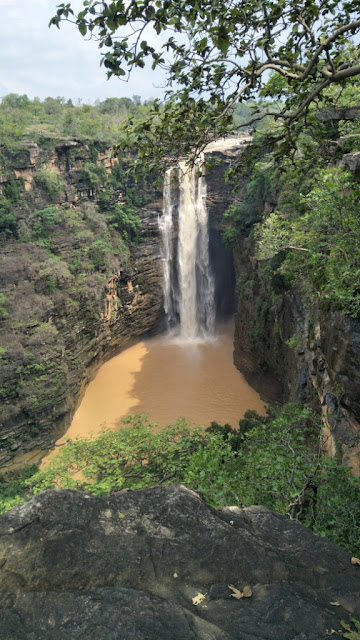
Amrit Dhara Falls is a waterfall located in Amritdhar Village in Manendragarh-Chirmiri-Bharatpur District in the Indian state of Chhattisgarh. It originates from the Hasdeo River, which is a tributary of the Mahanadi River. It falls from a height of 90.0 ft (27.4 metres). The waterfall is about 10.0–15.0 ft (3.0–4.6 metres) wide. The water from the falls cascades down from a great height, creating a beautiful misty ambiance. There is a beautiful Shiva temple situated close to this waterfall, A festival called Amritdhara Mahotsav is organized in honor of Lord Shiva of this temple by the district administration every year on Maha Shivaratri.


Connectivity

The falls is located at about 11 Kms from Nagpur, 11 Kms from Nagpur Road Railway Station, 24 Kms from Chirmiri, 29 Kms from Manendragarh, 39 Kms from Baikunthpur, 68 Kms from Bharatpur, 214 Kms from Bilaspur Airport and 330 Kms from Raipur Airport. The waterfall is situated at about 11 Kms to the north of Nagpur on the Manendragarh-Baikunthpur road NH 43.

Location

Telhar Waterfall, Bihar

Telhar Waterfall, Bihar

Telhar Waterfall is a waterfall located near Karar Village in Kaimur District in the Indian state of Bihar. This waterfall is situated on the Rohtas plateau and located close to the origins of Durgavati River. The waterfall is about 80 meters high and falls into the Telhar Kund, situated at the bottom of the waterfall. It is surrounded by amazing views on all sides and is perfect picnic spot. This waterfall is situated close to Durgavati Dam.


Connectivity

The falls is located at about 750 metres from Karar Bus Stop, 3.5 Kms from Karar, 25 Kms from Adhaura, 32 Kms from Bhabua, 46 Kms from Bhabua Road Railway Station, 46 Kms from Mohania, 115 Kms from Varanasi Airport and 122 Kms from Varanasi. The falls is situated on Bhabua to Adhaura route.

Location

Karkatgarh Waterfall, Bihar

Karkatgarh Waterfall, Bihar

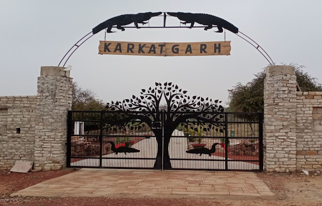
Karkatgarh Waterfall is a waterfall located in Karkatgarh Village in Kaimur District in the Indian state of Bihar. This waterfall is situated on Karmanasa River in Kaimur range. It is a natural habitat of the crocodile. It was a crocodile hunting place for Mughal rulers and British officials. It is said that the British officials constructed a dak bungalow with a view on the 300 feet wide and 100 feet high waterfall. British officials Henry Ramsay mentioned it as the finest fall surrounded by beautiful sceneries. The fall is now part of the Kaimur Wildlife Sanctuary established in 1979 and the hunting of crocodiles and other animals is now prohibited. It is currently a crocodile conservation reserve.


Connectivity

The falls is located at about 27 Kms from Chainpur, 40 Kms from Bhabua, 55 Kms from Bhabua Road Railway Station, 55 Kms from Mohania, 68 Kms from Chandauli, 99 Kms from Varanasi and 136 Kms from Varanasi Airport. The falls is situated at about 27 Kms to the south west of Chainpur on Bhabua to Varanasi route.

Location

Kakolat Falls, Bihar

Kakolat Falls, Bihar

Kakolat Falls is a waterfall located in Kakolat Village near Thali Bazar in Nawada District in the Indian state of Bihar. It is situated on the Kakolat hill, located on the borders of Bihar and Jharkhand. It is a beautiful waterfall and is one of the most visited places in Bihar. This falls was rediscovered by Mr. Francis Buchanan in 1811.


Legends

As per legend, a king was cursed to become a python by a sage Ashtabakra during Treta Yuga. The king in the form of python lived near the Kakolat Falls. He got rid of the curse by the visit of Pandavas to this place during their exile. It is said that any person who bathed in this waterfall would never be reborn as a snake. Hence, several devotees take bath in the waterfall during Vaisakhi or Chaitra Sankranti. It is also believed that Lord Rama with his wife Sita and his brother Lakshmana lived here during their exile.


The Waterfall

The waterfall is situated on the Kakolat hill and surrounded by dense forest. The waterfall cascades down from a height of about 160 feet and forms a deep natural pond at the base of the waterfall. Bathing is allowed in the pond. The bathing area is divided into two sections for men and women to bath comfortably. It is large enough to accommodate around 100 men and women at a time. The herbs growing at the waterfall area are said to contain medicinal qualities. The water is said to be cool even in summer and is rich with minerals which the locals claim to cure some ailments.


Connectivity

The falls is located at about 6 Kms from Thali Bazar, 15 Kms from Akbarpur, 24 Kms from Gobindpur, 31 Kms from Nawada, 31 Kms from Nawada Railway Station, 55 Kms from Rajgir, 85 Kms from Gaya, 94 Kms from Gaya Airport, 141 Kms from Patna and 147 Kms from Patna Airport. The falls is situated at about 6 Kms to the south of Thali Bazar on Akbarpur to Gobindpur route.

Location

Dhua Kund Waterfall, Mahua Dihra, Bihar

Dhua Kund Waterfall, Mahua Dihra, Bihar

Dhua Kund Waterfall is a waterfall located in Mahua Dihra Village near Sasaram City in Rohtas District in the Indian state of Bihar. This waterfall along with Manjhar Kund waterfall is situated on Kaimur Hill. This waterfall is also called as Dhuan Kund.


The Waterfall

The waterfall falls down from a height of about 300 feet. The waterfall is called as Dhua Kund (Dhua means Smoke) because a dense fog covers the area almost every time of the year. The fog looks like smoke from far and hence the name. The Dhua Kund and Manjhar Kund are the source of the Kao River in Bihar which later changes the name to Thori River and enters Bhojpur District and then finally fall in Buxar District. It is said that the water of this waterfall is rich in minerals and considered helpful in digesting food. The waterfall remains crowded throughout the year for its natural beauty. The Dhua Kund and the Manjhar Kund waterfalls have the capacity to generate 50-120 MW of hydroelectricity.


Festivals

A festival is organized every year during Raksha Bandhan in the vicinity of Dhua Kund and Manjhar Kund waterfalls.

Connectivity

The waterfall is located at about 7 Kms from Sasaram Tara Chandi Temple, 14 Kms from Sasaram Junction Railway Station, 15 Kms from Sasaram, 15 Kms from Sasaram Bus Stand, 50 Kms from Aurangabad, 138 Kms from Varanasi and 167 Kms from Varanasi Airport. The waterfall is situated at about 7 Kms to the south of Sasaram Tara Chandi Temple on Sasaram to Aurangabad route.

Location

Manjhar Kund Waterfall, Mahua Dihra, Bihar

Manjhar Kund Waterfall, Mahua Dihra, Bihar

Manjhar Kund Waterfall is a waterfall located in Mahua Dihra Village near Sasaram City in Rohtas District in the Indian state of Bihar. This waterfall along with Dhua Kund Waterfall is situated on Kaimur Hill.


The Waterfall

This waterfall is shorter than the nearby Dhua Kund. The impressive natural landscape and the picturesque has been the most interesting feature of the Manjhar Kund. It is the second most visited waterfall in Rohtas Forest Division and attracts lakhs of tourist specially during monsoon season. It is said that the water of this waterfall is rich in minerals and considered helpful in digesting food. 


The Dhua Kund and Manjhar Kund are the source of the Kao River in Bihar which later changes the name to Thori River and enters Bhojpur District and then finally fall in Buxar District. The Dhua Kund and the Manjhar Kund waterfalls have the capacity to generate 50-120 MW of hydroelectricity. There was the tradition of carrying the Guru Granth Sahib by the Sikh community to Manjhar Kund. The Sikhs stay here for three days.


Festivals

A festival is organized every year during Raksha Bandhan in the vicinity of Dhua Kund and Manjhar Kund waterfalls.

Connectivity

The waterfall is located at about 7 Kms from Sasaram Tara Chandi Temple, 14 Kms from Sasaram Junction Railway Station, 15 Kms from Sasaram, 15 Kms from Sasaram Bus Stand, 50 Kms from Aurangabad, 138 Kms from Varanasi and 167 Kms from Varanasi Airport. The waterfall is situated at about 7 Kms to the south of Sasaram Tara Chandi Temple on Sasaram to Aurangabad route.

Location

Ranthi Waterfall, Ranthi, Uttarakhand

Ranthi Waterfall, Ranthi, Uttarakhand

Ranthi Waterfall is a waterfall located in Ranthi Village in Dharchula Tehsil Pithoragarh District in the Indian state of Uttarakhand. This waterfall is situated close to Indian Nepal border. This waterfall is a seasonal waterfall. It only lasts in the rainy season, from June to October. This waterfall looks majestic during its full flow. The drive through the waterfall during its flow itself a unique experience to behold.


Connectivity

The waterfall is located at about 8 Kms from Dharchula, 9 Kms from Dharchula Bus Stand, 53 Kms from Budhi, 99 Kms from Pithoragarh, 277 Kms from Kathgodam Railway Station and 339 Kms from Pantnagar Airport. The waterfall is situated close to Dharchula Town on Pithoragarh to Budhi route.

Location

Najara View Point, Bhainsa, Madhya Pradesh

Najara View Point, Bhainsa, Madhya Pradesh Najara View Point is a view point located near Bhainsa Village in Jabera Taluk in Damoh Distric...