Friday, February 3, 2023

Kempty Falls, Mussoorie, Uttarakhand

Kempty Falls, Mussoorie, Uttarakhand

Kempty Falls is a waterfall located in Ram Gaon to the south of Kempty near Mussoorie Hill Station in Dehradun District of Uttarakhand, India. Kempty falls is one of the most popular picnic spot in Mussoorie.


History

Kempty Falls was developed as a tourist destination by a British officer John Mekinan, around 1835 CE. The britishers organized tea parties during colonial period at this place. Thus, the place came to be called as Camp Tea which later got corrupted to Kempty.


The Falls

The falls is situated at an elevation of 1364 metres (4475 feet) above the sea level. It falls from a height of 40 feet (12 m). It flows through five cascading falls in the downstream. There are two main falls with water falling into big pools. The pools formed at the bottom of the falls makes an excellent spot for swimming and bathing. The lower waterfall is quite popular and attracts large crowd while the upper one is relatively calm.


The falls are close to the main road and the first waterfall can be reached by about 5-10 minutes walk from the main road. The second waterfall can be reached through a roadway from the main road. Tourists can also reach other cascading parts of the falls by climbing down from the second falls. Tourists can enjoy the refreshing bath under fall and one can also enjoy boating in the nearby man-made pond.


Connectivity

The Falls is located at about 14 Kms from Mussoorie, 15 Kms from Mussoorie Library Bus Stand, 48 Kms from Dehradun, 49 Kms from Dehradun Railway Station, 49 Kms from Dehradun Airport and 71 Kms from Chakrata. This fall is located on Mussoorie to Chakrata route.

Location

Thursday, February 2, 2023

Sirki Waterfall, Pasighat, Arunachal Pradesh

Sirki Waterfall, Pasighat, Arunachal Pradesh

Sirki Waterfall is a waterfall located near Pasighat Town in East Siang District in the Indian state of Arunachal Pradesh. Pasighat is situated at the eastern foothills of the Himalayas at 155 meters (509 ft) above mean sea level. Pasighat is considered as the oldest town in Arunachal Pradesh.

The Waterfall

The waterfall is about 45 meters high, and it is perennial. There are two levels of the waterfall, and both the levels are beautiful but most of the visitors prefer the top-level waterfall, and one needs to hike to reach the waterfall. The surrounding areas has nice hiking trails and best for bird watching.


Connectivity

The falls is located at about 10 Kms from Pasighat, 11 Kms from Pasighat Bus Stand, 48 Kms from Murkongselek Railway Station, 91 Kms from Aalo, 160 Kms from Dibrugarh Town Railway Station and 169 Kms from Dibrugarh Airport. The falls is situated on Pasighat to Aalo route.

Location

Siko Dido Waterfall, Irgo, Arunachal Pradesh

Siko Dido Waterfall, Irgo, Arunachal Pradesh

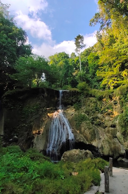
Siko Dido Waterfall is a waterfall located in Irgo Village in West Siang District in the Indian state of Arunachal Pradesh. The waterfall is about 200 feet high approximately. The falls has a plunge pool at its base. The rocks around the falls are covered in green moss. The falls is surrounded by picturesque mountains.


Connectivity

The falls is located at about 67 Kms from Mechuka, 119 Kms from Aalo, 161 Kms from Basar, 218 Kms from Pasighat, 368 Kms from Dibrugarh Town Railway Station and 377 Kms from Dibrugarh Airport. The falls is situated on Aalo to Mechuka route.

Location

Nuranang Falls, Jang, Arunachal Pradesh

Nuranang Falls, Jang, Arunachal Pradesh

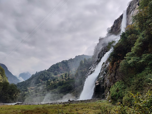
Nuranang Falls is a waterfall located in Jang Town in Tawang District in the Indian state of Arunachal Pradesh. This waterfall is also called as Jang Falls / Bong Bong Falls. It is one of the most spectacular waterfalls in the North Eastern India.


History

It is said that the Nuranang river and Nuranang falls are named after a local Monpa girl named Nura who had helped a soldier, Rifleman Jaswant Singh Rawat, Maha Vir Chakra (posthumous) in the 1962 Sino-Indian War and was later captured and executed by the Chinese forces. The waterfall came to limelight when a song from the movie Koyla featuring Bollywood actress Madhuri Dixit, ‘Tanhai Tanhai Tanhai’ was shot here and at Sangetser Lake in 1997. It was the first shot from the state shown in a Bollywood movie. Another song named "Mitha Mitha" from Hiya Diya Niya was shot in 2000.

The Waterfall

This waterfall is a cascade waterfall originates from the Nuranang River (a tributary of the Tawang River) over northern slopes of the mighty Sela Pass. It drops down from an altitude of 100 meters. There is a small hydel plant located near the base that generates electricity for local use. The best time to visit Nuranang waterfalls is from autumn to spring when the nature remains clear and water flow increases.


Connectivity

The falls is located at about 6 Kms from Jang, 31 Kms from Tawang, 148 Kms from Bomdila, 248 Kms from Bhalukpong Railway Station, 297 Kms from Tezpur Airport and 303 Kms from Tezpur. The falls is situated at about 6 Kms to the north of Jang on Tawang to Bomdila route. Regular bus service is available from Tawang to reach Nuranang falls.

Location 

Lumum Waterfall, Tippi, Arunachal Pradesh

Lumum Waterfall, Tippi, Arunachal Pradesh

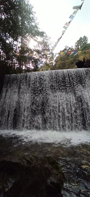
Lumum Waterfall is a waterfall located in Tippi Village near Bhalukpong in  West Kameng District in the Indian state of Arunachal Pradesh. This waterfall has an artificial pool built round it for the benefits of the tourists. The pool has provisions for the water to go with the drift out and is connected through a tunnel beneath the street to the Kameng river. It is said that the waterfall has been named after Rani Lumum of Hrussos (Akas). The waterfall known earlier as Mimjeow Kutsu by Hrussos (Akas), the indigenous people of the land.

Lumum was married to Drulyu Dususow, the head of Gohaintain Village, After the death of Drulyu Dususow, Lumum becomes the Nugom of Gohaintain Village, because of her wisdom and morality. Nugom means one who wields immense power and influence in village and also commends respect of the subject. Lumum was referred as Aka Rani by research scholars & simultaneously, Government of India recognized her and invited her to visit New Delhi, the capital of India, In November 1974 due to prolonged illness she passed away for heavenly abode.

Connectivity

The falls is located at about 5 Kms from Tippi, 9 Kms from Bhalukpong, 11 Kms from Bhalukpong Railway Station, 38 Kms from Nichiphu '0' Point, 61 Kms from Tezpur Airport, 67 Kms from Tezpur, 70 Kms from Tezpur Railway Station, 88 Kms from Bomdila, 165 Kms from Itanagar Airport, 183 Kms from Itanagar and 265 Kms from Tawang. The waterfall is situated on Tezpur to Tawang route.

Location

Choskorong Waterfall, Shergaon, Arunachal Pradesh

Choskorong Waterfall, Shergaon, Arunachal Pradesh

Choskorong Waterfall is a waterfall located in Shergaon Village in West Kameng district of Arunachal Pradesh. This waterfall is situated in the Choskorong forest in the Eastern Himalayas. The waterfall can reached after a small trek. The trek is small but slippery with rough large boulders strewn all over. Kids and elder people should avoid this trek. The pathway from Shergaon to the trek starting point is lined with apple orchards, red rhododendrons, and pine trees. 


Connectivity

The falls is located at about 2 Kms from Shergaon, 26 Kms from Rupa, 33 Kms from Kalaktang, 41 Kms from Bomdila, 115 Kms from Bhalukpong Railway Station, 164 Kms from Tezpur Airport, 170 Kms from Tezpur, 262 Kms from Tawang, 269 Kms from Itanagar Airport and 286 Kms from Itanagar. The falls is situated on Bomdila to Kalaktang route.

Location

White Surf Waterfall, Hut Bay, Andaman and Nicobar Islands

White Surf Waterfall, Hut Bay, Andaman and Nicobar Islands

White Surf Waterfall is a waterfall located in Hut Bay, the capital of Little Andaman in the union territory of Andaman and Nicobar Islands, India.  The place is covered with lush green forests and is ideal for nature lovers.


The Waterfall

It is situated in the midst of the tropical rainforest. It is said to be a huge waterfall before the tsunami hit Little Andaman, but it was broken into two smaller ones after the tsunami. Tourists can also trek to pool at the top of the waterfall. This waterfall can be reached after trekking of about 4 Kms. There are wild streams on the way to the waterfall. Tourists are not advised to venture into these streams as saltwater crocodiles have been spotted here. The best time to visit this waterfall is during post monsoon. There are entry fees to enter this waterfall.


Connectivity

The falls is located at about 7 Kms from Hut Bay Jetty, 7 Kms rom Indira Bazar Bus Stand and 10 Kms from Butler Bay Beach. The falls is situated on Hut Bay to Butler Bay Beach route. Tourists can catch a bus from Indira Bazaar to this place and need to walk for about 1 Km from the bus stop to reach this falls. Hut Bay wharf, a deep water wharf that can be approached through a gap in the coral reef, on the east coast of the island is the entry point of Little Andaman Island. Daily boat services connect Hut Bay wharf with Port Blair in seven hours voyage. Additionally, there are a helicopter services by Pavan Hans Ltd. and a sea plane connection available between Port Blair and Hut Bay. The flight time by helicopter or sea plane is approximately 40 minutes.

Location

Najara View Point, Bhainsa, Madhya Pradesh

Najara View Point, Bhainsa, Madhya Pradesh Najara View Point is a view point located near Bhainsa Village in Jabera Taluk in Damoh Distric...