Saturday, September 14, 2024

Najara View Point, Bhainsa, Madhya Pradesh

Najara View Point, Bhainsa, Madhya Pradesh

Najara View Point is a view point located near Bhainsa Village in Jabera Taluk in Damoh District in Madhya Pradesh, India. It is situated inside the dense forests of Veerangana Durgavati Tiger Reserve. It is situated at the top of a hill and offers breathtaking views of the Veerangana Durgavati Tiger Reserve.


Connectivity

The view point is located at about 5 Kms from Bhainsa, 14 Kms from Singrampur, 27 Kms from Jabera, 39 Kms from Tendukheda, 65 Kms from Jabalpur, 67 Kms from Damoh, 70 Kms from Jabalpur Railway Station, and 83 Kms from Jabalpur Airport. The viewpoint is situated at about 14 Kms to the north west of Singrampur on the Jabalpur to Damoh route.

Location

Nidan Waterfall, Katangi, Madhya Pradesh

Nidan Waterfall, Katangi, Madhya Pradesh

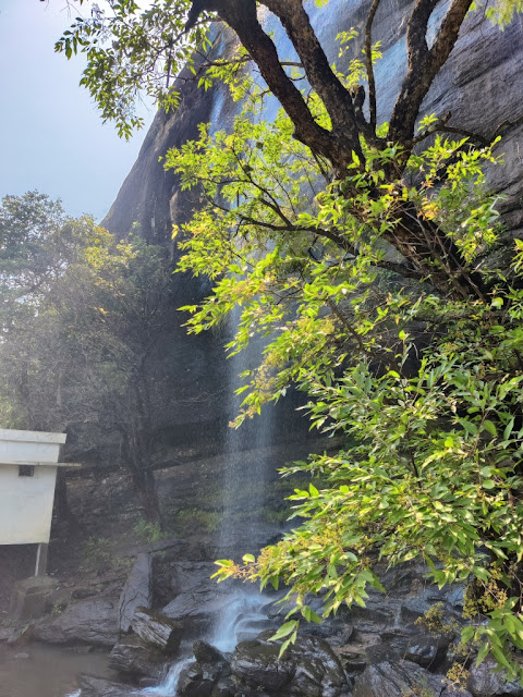
Nidan Waterfall is a natural waterfall located in Katangi Village in Shahpura Taluk in Jabalpur District in Madhya Pradesh, India. It is also called Katangi Waterfall / Nidan Kund. It is one of the scenic waterfalls in Madhya Pradesh. It is situated inside the dense forests of Veerangana Durgavati Tiger Reserve.

The Waterfall

This waterfall fall from a height of more than 100 feet. There are steps like formation on the black rocks against the flow of the stream, so it makes a beautiful sight when the water flows down over these rocks. The waterfall is situated amidst dense forest. The best time to visit this waterfall is during monsoon and post monsoon.

Connectivity

The waterfall is located at about 3 Kms from Katangi Bus Stand, 39 Kms from Jabalpur, 44 Kms from Jabalpur Railway Station, 57 Kms from Jabalpur Airport and 68 Kms from Damoh. The waterfall is situated at about 3 Kms to the north of Katangi Bus Stand on the Jabalpur to Damoh route. The waterfall can be reached after a trek of about 1 Km from the parking area.

Location

Singorgarh Fort, Singrampur, Madhya Pradesh

Singorgarh Fort, Singrampur, Madhya Pradesh

Singorgarh Fort is an ancient hill fort located in Singrampur village in Jabera Taluk in Damoh District in Madhya Pradesh, India. It is known as one of the most magnificent forts of Gonds. It is situated inside the dense forests of Veerangana Durgavati Tiger Reserve. It is presently under the control of Archeological Survey of India.


History

The fort was built by the Pratihara Rajputs, who ruled in the Damoh region during the 14th century CE. The earliest inscription found in Singorgarh is dated to 1307 CE. The inscription records the name of the fort as Gaja-Singhadurggye, meaning the hill fortress of Gaja Singh. Gajsimha or Gaja Singh Pratihar was a Pratihar Rajput ruler after whom the fort is believed to be named. The Pratihara rule over Singorgarh probably ended with the invasion of the Delhi Sultan Ala-ud-din Khalji's forces, who were going to the Deccan and conquered Bundelkhand on their march.


The fort was conquered by the Gond ruler of Garha-Katanga, Sangram Shah in the 16th century CE. The fort was strengthened by the Gonds of Garha Kingdom. The fort was attacked in the June of 1564 during the invasion of the Garha Kingdom by the Mughal forces. During the invasion, Rani Durgavati, the ruling Queen of Gondwana, resided in Singorgarh and later moved to Chouragarh Fort in Narsinghpur due to the threat she faced during the invasion.

The Fort

This fort is situated on a hill in the dense forests of the Satpura range. The fort is in a ruined state. The fort spread over a vast area and many of its watch towers are still intact. The ruins of Rani Mahal, Hathi Darwaza and a huge bathing tank can be seen in the fort. There are many secret passages in this fort designed to confuse invaders and to provide safe passage for the king and queen.


It is said that there are tunnels deep inside the dungeons known only to Rani Durgavati and a handful of her army. One tunnel discovered by the Archaeological Survey of India (ASI) is said to lead to the hill fort of Madan Mahal. Singorgarh lake is situated close to the Hathi Darwaza. As per local folklore, there is a well inside this reservoir where the treasure of Rani Durgavati along with the Paras Pathar (Philosopher’s Stone) has been hidden.  


Connectivity

The fort is located at about 7 Kms from Singrampur, 19 Kms from Jabera, 44 Kms from Sihora, 46 Kms from Sihora Road Railway Station, 57 Kms from Jabalpur, 59 Kms from Damoh, 62 Kms from Jabalpur Railway Station and 75 Kms from Jabalpur Airport. The fort is situated at about 7 Kms to the west of Singrampur on the Damoh to Jabalpur route.

Location

Veerangana Durgavati Tiger Reserve, Madhya Pradesh

Veerangana Durgavati Tiger Reserve, Madhya Pradesh

Veerangana Durgavati Tiger Reserve is a tiger reserve spread across Damoh, Sagar and Narsinghpur Districts of Madhya Pradesh in Central India. It is the seventh tiger reserve in Madhya Pradesh. The tiger reserve is named after Rani Durgavati, a queen of the Gondi people.


History

The sanctuary was notified by the Government of Madhya Pradesh in 1996. The Madhya Pradesh Government recently announced the establishment of the Veerangana Durgavati Tiger Reserve, marking the seventh tiger reserve in the state and the 54th in the country.

The Tiger Reserve

The tiger reserve covers an area of about 2339 sq kms. The core area is about 1414 sq kms and the buffer area is about 925.12 sq kms. The tiger reserve is formed by combining the Nauradehi and Durgavati Wildlife Sanctuaries. A green corridor linking Panna Tiger Reserve (PTR) with Durgavati will be developed for the natural movement of the tiger to the new reserve. The parts of the reserve fall under the Narmada and Yamuna River basins. The Singorgarh Fort is located within the reserve.

Flora:

The reserve is predominantly tropical mixed dry deciduous forest and some teak (Tectona grandis) forests with trees accounting for 70 of the 121 species of plants found here. The trees found in the reserve are Indian Kino (Pterocarpus marsupium), Saja (Terminalia alata), Dhaora (Anogeissus latifolia), Mahua (Madhuca indica), Amla (Phyllanthus emblica), Palash (Butea monosperma), Ber (Ziziphus mauritiana) and Bakli (Lagerstroemia parviflora).

Fauna:

The reserve is home to approximately 15 tigers, making it a vital habitat for endangered species. The reserve is home to 18 species of mammals. The mammals found in the reserve are tiger, leopard, wolf, jackal, Indian fox, striped hyena, nilgai, chinkara, chital, sambar, black buck, barking deer, common langur, rhesus macaque and sloth bear. The reserve is also home to 177 species of birds, 16 species of fish and reptiles and 10 species of amphibians.

Connectivity

The tiger reserve is located at about 7 Kms from Singrampur, 19 Kms from Jabera, 45 Kms from Sihora, 47 Kms from Sihora Road Railway Station, 47 Kms from Damoh, 58 Kms from Jabalpur, 63 Kms from Jabalpur Railway Station and 76 Kms from Jabalpur Airport. The tiger reserve is situated on the Damoh to Jabalpur route.

Location

Kozhippara Waterfall, Kakkadampoyil, Kerala

Kozhippara Waterfall, Kakkadampoyil, Kerala

Kozhippara Waterfall is a natural waterfall located in Kakkadampoyil Village near Nilambur Town in Kozhikode Taluk in Kozhikode District in Kerala, India. This waterfall is also known as Kakkadampoyil Falls. The waterfall is situated in the western ghats on the border of the Malappuram district. The waterfalls is looked after by the Kerala forest department that comes within the Edavanna Forest Range.


Connectivity

The waterfall is located at about 3 Kms from Kakkadampoyil Junction Bus Stop, 22 Kms from Thiruvambady, 26 Kms from Nilambur, 28 Kms from Nilambur Road Railway Station, 32 Kms from Edavanna, 44 Kms from Kozhikode Airport, 49 Kms from Malappuram and 52 Kms from Kozhikode. The waterfall is situated at about 26 Kms to the north west of Nilambur on the Kozhikode to Gudalur route.

Location

Keralamkundu Waterfall, Karuvarakundu, Kerala

Keralamkundu Waterfall, Karuvarakundu, Kerala

Keralamkundu Waterfall is a natural waterfall located in Karuvarakundu Town near the Silent Valley National Park in Nilambur Taluk in Malappuram District in Kerala, India. It is one of the major water falls in Malappuram and was included in the map of national adventure tourism in 2016.


The Waterfall

This waterfall is situated at an altitude of about 1350 feet above sea level at the foothills of Kumpanmala Mountain in the Western Ghats. The waterfall is formed by the confluence of streams flowing through various tributaries on the mountain. The waterfall falls from a height of about 150 feet. As the streams flow through the dense forests which is rich in medicinal herbs, the water is believed to have many medicinal properties. The waterfall forms a pool at its bottom from which the water keeps flowing down through the rocks.


Connectivity

The waterfall is located at about 6 Kms from Karuvarakundu, 7 Kms from Karuvarakundu Bus Stand, 15 Kms from Tuvvur Railway Station, 31 Kms from Perinthalmanna, 35 Kms from Nilambur, 37 Kms from Manjeri, 37 Kms from Mannarkkad, 49 Kms from Malappuram and 59 Kms from Kozhikode Airport. The waterfall is situated at about 6 Kms to the east of Karuvarakundu on the Mannarkkad to Nilambur route.

Location

Kattikkayam Waterfall, Pazhukkakanam, Kerala

Kattikkayam Waterfall, Pazhukkakanam, Kerala

Kattikkayam Waterfall is a natural waterfall located in Pazhukkakanam Village in Meenachil Taluk in Kottayam District in Kerala, India. It is one of the less explored destinations in Kottayam District. This waterfall is about 70 meters high. The pool formed by the waterfall at its bottom is the main attraction here. It is considered one of the most unsafe waterfalls in Kerala due to the gaps in the rock under the pool which can cause danger. The waterfall can be reached by one kilometer trekking upwards from Mechal or downwards from Pazhukkakanam.


Connectivity

The waterfall is located at about 5 Kms from Illikkal Kallu, 6 Kms from Mechal, 9 Kms from Moonnilavu, 14 Kms from Melukavu, 14 Kms from Edamaruku, 17 Kms from Erratupetta, 19 Kms from Poonjar, 29 Kms from Thodupuzha, 54 Kms from Kottayam, 55 Kms from Kottayam Railway Station and 83 Kms from Kochi Airport. The waterfall is situated at about 14 Kms to the east of Edamaruku on the Erratupetta to Thodupuzha route. 

Location

Kanthanpara Waterfall, Meppadi, Kerala

Kanthanpara Waterfall, Meppadi, Kerala

Kanthanpara Waterfall is a natural waterfall located near Meppadi Village in Sultan Bathery Taluk in Wayanad District in Kerala, India. It is one of the famous tourist destinations in Wayanad.


The Waterfall

The waterfall is on the Chaliyar River and has a total height of around 30 meters. The waterfall is located at two levels amid lush green bamboo gardens and natural forests. This waterfall can be seen like a silver thread when viewed from the Soochipara waterfall. The best time to visit this waterfall is during the post-monsoon and winter months. The forest department offers bird-watching trips and a two-hour riverside trek on the banks of the Chulika / Chaliyar River.


Connectivity

The waterfall is located at about 8 Kms from Meppadi Bus Stand, 8 Kms from Meppadi, 25 Kms from Vythiri, 31 Kms from Wayanad, 31 Kms from Sultan Bathery, 86 Kms from Kozhikode Railway Station, 92 Kms from Kozhikode Airport and 103 Kms from Ooty. The waterfall is situated at about 8 Kms to the south east of Meppadi Bus Stand on the Vythiri to Ooty route.

Location

Erachilpara Waterfall, Kovilkadavu, Kerala

Erachilpara Waterfall, Kovilkadavu, Kerala

Erachilpara Waterfall is a natural waterfall located in Kovilkadavu Village in Devikulam Taluk in Idukki District in Kerala, India. Erachilpara Waterfall is also called Irachilpara Waterfall. It is one of the largest waterfalls in Munnar. It is a seasonal waterfall, and the water falls from a height of about 300 metres without force. The waterfall gives an experience of good rain shower. This waterfall is situated upstream of the Thoovanam Waterfall. The best time to visit this waterfall is during the monsoon season.


Connectivity

The waterfall is located at about 4 Kms from Marayoor, 4 Kms from Marayoor Bus Stand, 12 Kms from Kanthalloor, 39 Kms from Munnar, 51 Kms from Devikulam, 49 Kms from Udumalaipettai Railway Station, 50 Kms from Udumalaipettai and 147 Kms from Kochi Airport. The waterfall is situated on the Munnar to Udumalaipettai route (State Highway 17). The waterfall is situated close to the main road and can be reached after a walk for about 10 minutes from the road. The waterfall is situated on the Marayoor to Kanthalloor route.

Location

Ekayam Waterfall, Peruvanthanam, Kerala

Ekayam Waterfall, Peruvanthanam, Kerala

Ekayam Waterfall is a natural waterfall located near Peruvanthanam Village in Peerumedu Taluk in Idukki District in Kerala, India. The waterfall is about 70 feet high and forms a pool at its bottom. The waterfall is surround by lush green forests and plantations. The best time to visit this waterfall is during monsoon and post monsoon.


Connectivity

The waterfall is located at about 5 Kms from Peruvanthanam Bus Stop, 13 Kms from Mundakayam, 42 Kms from Periyar, 52 Kms from Kumily, 64 Kms from Kottayam Railway Station, 65 Kms from Kottayam and 119 Kms from Kochi Airport. The waterfall is situated at about 5 Kms to the north east of Peruvanthanam Bus Stop on the Kottayam to Kumily route.

Location

Kuno National Park – The National Park

Kuno National Park – The National Park The national park is situated in an isolated hill, sloping in all directions. The national park ...